Sunday, June 7, 2009

An 80 Mile Epic Ride

This past weekend marked my fourth installment of High Country Pathway fun-n-games. June of 2007 had me attempting the entire 80 miles, aborting after 28 1/2 miles of trail. September of 2007 and '08 had me attempting, and completing, the 50ish mile section from Osmun Road back to the State Park. This year would mark my second crack at doing the full 80 mile loop.

Jon and I hit the road in the morning on Friday, and stopped for a noontime lap around Hanson Hills. At the trailhead, we bumped into one of Jon's fellow Mountain Bike Patrollers. We headed over with him and his group to the Keg 'O Nails bar in Grayling. After conversation, lunch, and a pint, Jon and I swung up to Big Buck to pick up some weekend "supplies".

We rolled into the group campsite in the evening, set up camp, had dinner, and spent the evening sitting around the campfire.

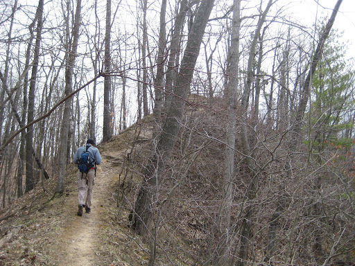
Five of us (Todd, Wendy, Dan, Tom and myself) rolled out at around 8:30 am, intending to do the entire 80 mile loop. We headed out counter-clockwise from the campground, so as to do the rougher and more overgrown stuff first. Coincidently, all except Dan were on singlespeeds.

About 10 miles in, Dan pulled ahead of the group. He must've been on a mission, as this would be the last I saw him until we finished the ride. The remaining four of us rode together for the most part.


Overlooking the Tomahawk Creek Flooding, not far from where my profile photo was taken.


Snack time at M33; Todd and Wendy enjoying a break.


On the Canada Creek bridge. Tom is in the background.
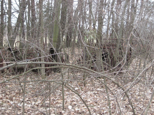

Canada Creek


Boardwalk near Dog Lake.

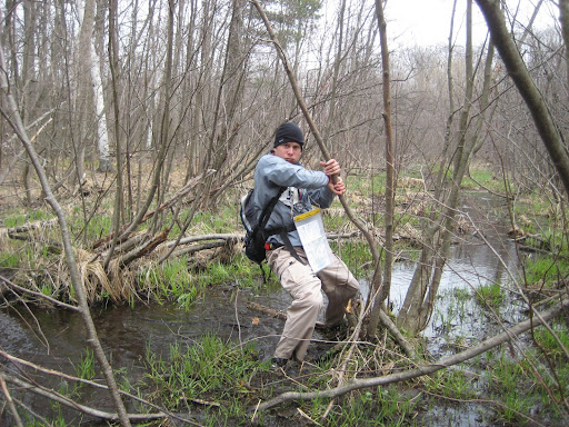
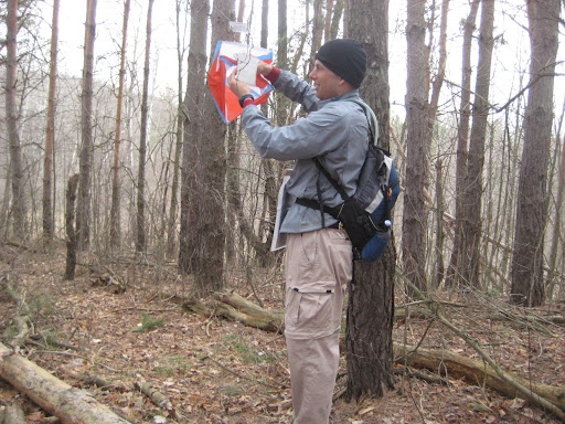
I didn't take as many photos as in trips past; the length of the ride didn't allow for many stops. Most of my photos were from the section between M33 and Osmun Road, since this is the stretch I hadn't ridden previously. If you dig into the musty archives from September 2007, "The Blue Dots Part 1" will take you from Clear Lake up to a few miles short of M33. "The Blue Dots Part 2" and my post from Last September take you from Osmun Road back to Clear Lake State Park.


Riding the boardwalk. I'm starting to get better at riding these.

I spent some of the time riding solo, and the rest riding with Todd, Tom and Wendy. After the stop at Pigeon Bridge, I rode off solo from the group, having a blast on the trail, climbing most of the hills, and actually riding the really long narrow boardwalk just before Tubbs Creek. Until... coming down some nice flowing trail, I saw two oncoming riders ahead. After a quick double-take, I realized it was Todd and Wendy. After a short debate, I let myself be convinced that they were heading the proper way (which ended up being the case), and after about a mile of backtracking familiar looking trail, we made another turn at a clearing. In hindsight I think I got turned around at this clearing when I circled it looking for the continuation of the trail.

I rode the remainder of the trail with Todd and Wendy, and we were joined by Tom at the base of Rattlesnake Hill. Here we donned lights and rode as a group to the campground.


Rattlesnake Hill overlook

We were on the trail for about 12 1/2 hours, of which about 10 1/2 hours was spent moving. But in the end, all of us that set out to complete the full 80 miles did indeed finish the full 80 miles.

Thursday, June 4, 2009

Midwest Mountain Bike Summit

This past weekend I elected to forego racing, and instead chose a long weekend of learning about MTB advocacy and trail building. Yeah, and there was some riding and beer drinking thrown in there also.

I left work Thursday evening, and made the trek over to Grand Rapids. After setting up my tent, I made my way over to the welcome reception. Dinner was a (very tasty) pig roast, and tasty Founders beer was on tap.

Friday held seminars on various advocacy topics. The first one I attended was about how to organize and maintain a successful advocacy club. This was hosted by Kelly and Collins Bishop, one of the IMBA trail care crews. Next, I learned about how to write a grant request. Finally, there was a classroom session on trail building. Here I learned many of the guidelines on how to build a sustainable trail for multiple user groups.
After the advocacy session, I made my way over to the Cannonsburg Ski Area, where myself and a couple others were given a guided tour by Rick Plite (a member of the local chapter of the MMBA). He actually laid out a significant portion of the trail, and rides it regularily, which made it "fun" to keep up with him.

The night was capped off with a late dinner followed by beers around the fire.

Saturday morning was spent putting my new trail building knowledge to the test. We went over to the Cannonsburg State Game Area, where we practiced laying out a stretch of trail.
Afterwards, a group of us decided to ride a lap of the Ski Area trail. Trek had their demo trailer there, so I decided to try out a Top Fuel (their 4" travel XC race bike). This was my first time ever riding a full suspension bike on singletrack, and it made for an interesting experience. The bike rode very nicely, but I could tell that I was tentitive in the corners. This was due to a combination of the 26" wheels, straight bars, different tires, and the effects of the suspension (i.e. drastically different than my bike. All-in-all a nice bike, but I'm definately wanting to stick to singlespeed.

Over the log pile on the Fuel. The blur makes it look like I'm going fast. (Actually I was going pretty fast)
Over the logs at the Ski Area
Photo courtesy of Diane Ursu

Afterwards, a couple dozen of us headed over for a guided lap of Luton Park. This is a new trail in a new county park. The Western Chapter of the MMBA did a great job laying this trail out. Nothing steep, but still a fair bit of climbing in a couple of the loops. Very nice flow. A few technical spots, and a number of fast spots.
After the group lap, a few of us stuck around to do a second lap.

Riding the Luton Trail
Riding the new trail at Luton Park
Photo courtesy of Diane Ursu

Saturday evening was spent at Founders Brewery, where we watched the Wings beat up on the Penguins.

Sunday morning we met at the Cannonsburg State Game Area for the final group ride. I was put into the "fast" group, with Tim from the Founders MTB team, Steve (the owner of Ada Bikes), and another guy who's name I don't remember. As luck would have it, we were all riding singlespeeds. We rode part of the game area, then ducked out and headed on the roads over to Luton. After a lap of Luton, more roads took us to a paved path, which had a few rolling hills. This took us to the ski area where we rode a lap. Finally it was back to the game area where we finished the lap there. It ended up being a 40 mile loop.

Good trails, good people, good beer, and good MTB related information. All this made for a great weekend.

Friday, April 24, 2009

Broadsides of Barns

I went shooting with my dad yesterday. We spent about an hour and a half at the indoor range at the Oakland County Sportsmans Club.

This was from my Ruger Single Six 22lr, which has a 7 1/2" barrel. Distance was 30 feet to the target.


This was from dad's Colt Cobra 38 Special, which has a 2" barrel. Distance was 30 feet to the target.


Not bad for someone who doesn't shoot a whole heck of a lot.

Monday, April 20, 2009

Adventures in Racing

This past weekend, my teammate Ben and I participated in our first ever Adventure Race. This is a race where you attempt to locate a number of checkpoints using an assortment of travel modes, specifically paddling, bicycling, and trekking. This is something I've been wanting to do for some time now, so when Ben suggested the race while at the MMBA expo, I willingly dropped my original plans of doing the Paris-Ancaster race.

Saturday was spent putting the finishing touches on my gear, followed by an early bedtime. I woke on Sunday and headed out to the Walleye-Pike boat launch on the Holloway Reservoir, where the race was staged. After Ben arrived, we checked in with the promoters, and prepped for the race. There was a short pre-race meeting, where we were given the maps and race instructions, and we were left with a half hour in which to discuss final strategies.

We also used this as a chance to have a pre-race photo taken.


This particular race had us begin in the canoes, followed by the bikes, and finishing with an orienteering course taken on foot.
Ten minutes prior to the start (8am), we headed down to the shore. We staged the canoe, and when the promoter gave the "GO" command, we were off. Paddling into the wind to start...


We had to beach the canoe, get out, and run to the checkpoint. Repeat for each checkpoint.


After a couple hours, we ditched the canoe in favor of bikes. We rode out towards Columbiaville and Otter Lake in search of the elusive checkpoints. We started out doing great, working up from our ~1/3 way back positioning after the paddle.


We were coming up to the left turn which would take us to checkpoint #18, and then on the return trip.

One of us: "Do we have all the checkpoints?"
Ben: "Checkpoint 10... 11... 18?"
Me: "18 should be the last one."
Ben: "17?"
Me: "F***! We're making a right instead of a left."

After an extra 4 miles, we rolled back into the transition. We did indeed make up a few places even with our "diversion".

We dropped our bikes, donned our trail shoes, refilled water, and headed out into the final trekking portion. Here we would use our map, compass, and bushwacking skills to locate the final 18 checkpoints. Side note: for the bike and paddle portions, all checkpoints were mandatory. For the trekking portion, you could get as many or as few as possible, as long as you got back to the start by the 4pm cutoff time. A minimum of 3 were required to remain a ranked team. Placing was determined by the number of points taken, with ties being broken by finishing time. For example, 3 teams get 14 of the trekking checkpoints. Team 1 finishes at 3:30pm, team 2 finishes at 3:15pm, and team 3 finishes at 4:05pm the placing would be as follows: team 2, followed by team 1, with team 3 receiving a DNF (missed cutoff time). So, there was some strategy and time management involved... do you risk missing the cutoff to get that one more checkpoint.

We headed up hill...


Through swamps... this one was not too bad


Gathering checkpoints...


And making a couple wrong turns. We spent a half hour searching for one checkpoint only to figure out we were not too far from one we had already got. Oops!

We got to learn about the drinking habits of inhabitants long ago...


And about all things farming...


Unfortunately photos don't exist of the worst of the swamps. The cutoff time was fast approaching, and we had a fair bit to go to get out of the woods. The safe and sure way was to head straight North, where we would eventually hit Stanley Road where we would have a mile road run home. Straight North happened to take us through swamps ranging from ankle deep to "boys" deep.

Wet from hips down, we emerged onto Stanley road, and had a painful (for me) run to the finish. We made it in with 1 minute to spare!

The results had us finishing 17th overall out of the 54 teams which finished. We got 14 of the 18 checkpoints in the final trekking portion; we did see another of the checkpoints, but time was running short and we made the (wise) decision not to hike around the swamp to get it.

We both had a great time, learned a lot about navigation, and will definitely be doing this again.

Tuesday, March 24, 2009

Jose the Backroads Dreamboat

After work, I hopped on the new San Jose, and headed out into BFE. My route took me east towards Capac, as the wind was blowing out of the east... I like to have the tailwind for the latter part of the ride if possible. Necessary tweaks had made to the saddle position... the saddle was moved forward quite a bit, and the nose was angled down, and the track cog was installed and rear wheel flipped around.
After a quick jaunt to the North, I headed to the east on the wind tunnels that were Weyer and Petz roads. Jose handled the dirt great, taking the sting out of the bumps. In fact, the ride didn't seem much rougher than the fat tired beast on the dirt. Having the drops allowed me to get into a bit more aerodynamic position, which helped greatly.
I turned south on Capac Road, and headed through downtown Capac. My route eventually took me south to Dryden Road, which I took back across Van Dyke. The last few miles were ridden in gradually decreasing light, making me thankful for my flashing taillamp and my headlamp... even though I saw very few cars.
After 31.5 miles, I rolled in, having enjoyed a great ride on a great bike.

Friday, March 20, 2009

Spring


Time to get outside. "5-Nut Hill" here I come!


In other news, the stable grew by one the other day. I was able to track down a leftover 2008 Bianchi San Jose. This will become my "go-to" ride for mixed dirt/paved road riding. Also, I'm planning on doing a bit of cyclocross racing this fall.
Photobucket

The maiden voyage was this past Tuesday; 28 miles mostly paved, but with a mile of dirt thrown in. The ride was very nice, not too much more jarring than the fat-tired beast on the dirt. The cockpit still needs to be tweaked: saddle feels a bit skewed, saddle is too "nose up", I think the saddle may not be far enough back, but these can be quickly addressed. Also for road use I'll need to get some different gearing. The stock 42:17 was a bit "spinny". I've only ridden it free so far, and I'll definately need taller gearing when I put the track cog on.

Tuesday, January 6, 2009

2009 Goals

1: Start the race season at under 150lbs
2: Finish the Lumberjack 100 in under 9 hours - also top 10 in Singlespeed
3: Race in and finish a second race in the NUE series (Mohican, Wilderness, or Shenandoah)
4: Race a solo 12 hour race
5: Podium at Iceman - finish in 1:45 or less if weather conditions are conducive
6: Race in a cyclocross race