We woke the next morning, got our supplies ready to be staged in a couple of cars, and headed out to Osmun Road.

Organizing supplies

Getting ready at Osmun Road

Yours truly at the start
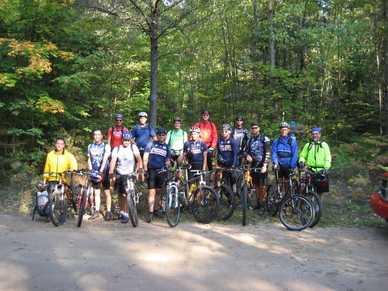
The group
We hit the trail, and for the first mile or so were greeted with some gnarled root sections and numerous boardwalks. I rode the roots, and walked the boardwalks. There were a couple trees we had to portage our bikes over, including one where it was a challenge to do even that.
The trail opened up, and we had a few miles with a great flow. The trail continued through Pigeon River state forest campground, past an overlook, and through some meadows.

Stopped at the first overlook
After a while we hit the Shingle Mill Pathway, were things opened up. Up until this time, I had been riding with 4 others out in front of the rest of the group. Myself and one other guy decided to take the eastern leg of the Shingle Mill, which was 2 miles longer, while the other 3 took the western leg. Some screaming downhills led us past Section Four Lake, a sinkhole lake. We had some rollers, a "neverending boardwalk" section, and then finally the first car at Pigeon Bridge.

Section Four Lake

Lunch stop at Pigeon Bridge
At Pigeon Bridge, the four guys I had been riding with forged on ahead. The 3 who took the western leg were getting ready to go, and the guy I rode the eastern leg with didn't want to stop. I waited for the rest of the group and had lunch with them.
I took off with one other guy from lunch, and, having fun on the nice flowing stuff that followed, pulled away from him. This left me to ride the stretch to Rattlesnake solo. I got into a zone here, flowing the trail, enjoying the views and changing flora.

Near the firetower site
I came to a road crossing. Here I didn't see any evidence where to go, so I hung a right and rode about 3/4 mile down the road. No blue dots! I turn around and ride past Town Corner campground, and see the posts for a HCP crossing. Here I hang a right onto the trail, and ride into the campground. Nothing looks familiar. I ride up and down the campground looking for the strangely missing blue dots. Get brave and ask some campers if they saw any other riders. A number of different campers reported seeing another rider about 20 minutes prior to seeing me (reports of yellow on the front of the jersey). Nobody knows anything on where the trail picks back up. Finally I find a guy who looks like a plumped up lost member of ZZ Top, and ask if he can help. He says "Sure, I have a map over on the table". We head over to the table where he has a map lying under an aluminum baseball bat (strangely, no other sporting equipment of any sort, let alone baseball gear, can be found). He points to the map, and directs me to ride out the enterance, hang a left, ride down the road, and at the top of a big hill there would be a clearing where I could find the trail. I said "have a great weekend", and rode off, out the campground, down the road, right back to where I first emerged from the woods. A bit of looking around revealed tire tracks entering the field directly across the road from where I had originally emerged! Oops. My little diversion into Town Corner campground probably added 45 minutes and 7 miles to my ride.

Town Corner Lake

Along the trail

Town Corner Campground - the site of my diversion
I crossed the Black River, and the trail took me into some lowlands. I rode some boardwalks, walked most, rode some rooted sections, and walked others. After I crossed Tubbs Creek, the trail climbed out of the lowlands. The stretch that followed was a great flowing section through some mature hardwoods with very little undergrowth.

Bridge

Roots and boardwalks

Tubbs Creek boardwalk

Back into the hardwoods
I came out onto a road, which I took to the car at the base of Rattlesnake Hill. Here I rejoined the group, where we had a snack and replenished our water supplies.

At the base of Rattlesnake Hills

Reaction to arm-scratchers
The climb up rattlesnake was hike-a-bike, and a tough hike-a-bike at that. But the view, and sweet downhill that followed, was more than worth it

How we got up Rattlesnake Hill

On top of Rattlesnake Hill

Rattlesnake Hill
After Rattlesnake Hill, the trail flowed through ferns, a field, another moderate hill, a short swamp/root/boardwalk section, and then finally out onto a roadway. We took the roadway back to the state park, entering through the day-use area.
After a shower, we ate, drank, and hung out around the fire.

Cruising back to the campground

2 comments:
What beautiful country to ride. You just got to love Michigan in the fall. It looks like a fun, interesting ride and a good time.
Thank you for taking time to share your ride in written word. I feel closer to understanding your passion for riding because of your blog.
Hmm that doesnt look like a TSB jersey... ;)
Looks like a cool ride though.
Post a Comment